Ah...the Classic Spur of the Moment Peru Trip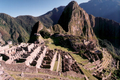
in the Western hemisphere with my brother Rob and best friend Dan a year from then. Then suddenly I received tragic news . . . Dan's vacation schedule has changed and this trip to Argentina will have to be postponed. Luckily I have many other friends who like to travel. So after only a couple days of looking checking the options, I jumped on a trip to Peru that my friends Than and Brian had setup. Ah . . . much better, I only had to endure three weeks of training to climb 20,000 foot mountains and learn Spanish instead of drawing it out over a year, I did not want to be too prepared! That's right, three short weeks later Than, Brian, and I were South of the equator touring Inca ruins, climbing mountains, and drinking Pisco sours. 
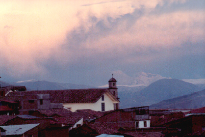
guessed it, very little sleep. We arrived in Lima, the capitol of Peru, around midnight and decided to stay up through the night playing cards in the airport so we looked and felt our best for the 6:00am flight to Cusco. It turns out that little sleep was one of the prominent trends for the trip. We got up later than 6:30 only once throughout the three week trip - might as well not waste any time. We were greeted in the claim area by Peruvian flute players who seamed to follow us around entire trip providing an authentic background soundtrack. 
|
|
 | |
|
|
|
|
|
|
|
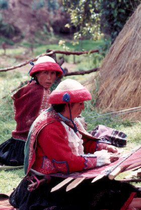
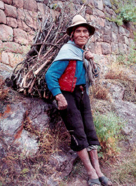
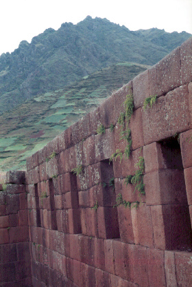 | ruins and markets around Cusco, but not before an amazing breakfast at Jacks. They had the most amazing pancakes toped with fruit and cream or a banana maple syrup compote. It was so tasty that we ended up eating breakfast there every morning we were in Cusco. That day we toured the Sacred Valley including the ruins and markets of Pisac, Urubamba, Ollantaytambo, and Chinchero. Many of the locals were wearing traditional brightly colored cloths. The markets were full of alpaca wool cloths, blankets, and bags. There were also many people selling pottery, paintings, and much more. It was neat to look at but that is all we did, we did not want to carry any more than we had to with most of the trip ahead of us. |
|
|
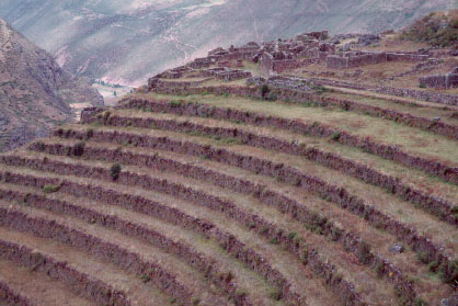
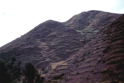
terraces that covered most every hillside and mountain. Most were built by the Incas and have been used by the locals in the same fashion for hundreds of years. Others were overgrown leaving the mountains with horizontal scars. Many of the houses were made of mud and straw adobe, especially in the outlying areas. And the roofs were either the terra cotta tiles or thatched. We spotted herds of llamas and vicunas looking like puff balls or drowned rats depending on how recently they had been shaved for their wool. | 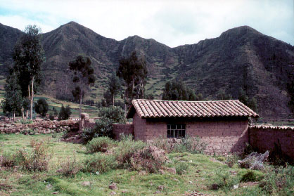
|
|
|
 |
the permits to go through to hike the Inca trail to Machu Picchu. So we decided to head South to tour around the country while the paperwork was being arranged. Cesar hooked us up with a plush bus down to the city of Puno which is on the shore Lake Titicaca. Before getting to the lake we first had to go up and through a mountain range. |
|
|
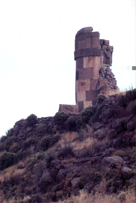
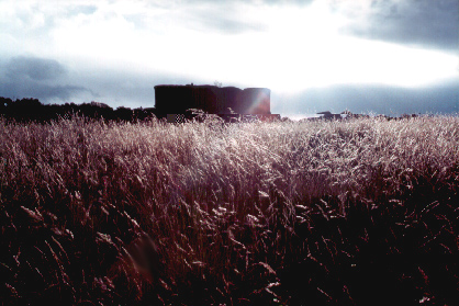
were grabbed by someone waiting for us and were whisked off for a tour of the ruins of Sillustani. There perched above Lake Titicaca were many chullpas, or burial tombs, in the form of huge stone towers. Due to superior Inca stonework, most towers remain standing even though the many earthquakes that constantly plague Peru. The one shown above was damaged by lightning strikes. |
|
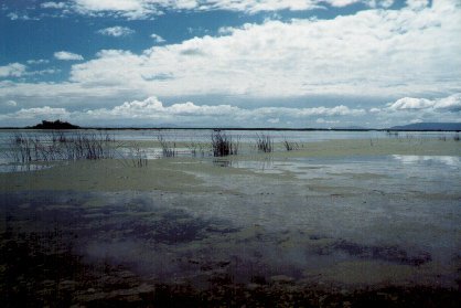
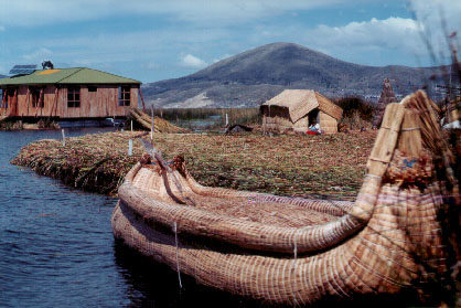
floating reed islands, one of which is shown below. These islands are constructed out of the reeds that grow in the shallow areas and are lived on by Peruvian natives. They are about 9 feet deep and up to 100 feet across. We met the natives and toured the houses on the islands. Some had solar panels for power but they were rare. Most of the time they drift on the lake and the people fish and make crafts. |
|
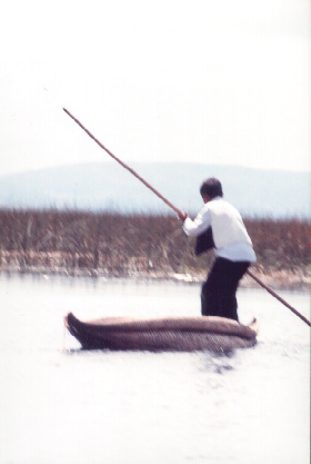
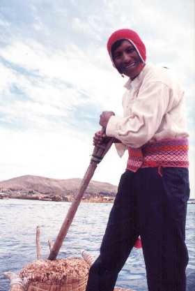
boats were made entirely of tightly woven and stacked reeds. We took a ride on one and the captain shown on the right below moved it across the water easily with a single oar positioned between two uprights. He gave the three of us each a chance at the oar and what little distance we moved was in the wrong direction . . . those things are a little tricky. |
|
 |
 |
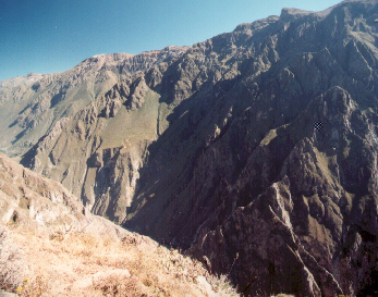 |
Chivay, perched on the edge of a huge canyon. The Colca Canyon and its neighbor Cotahuasi Canyon are the deepest canyons in the world measuring from the river bottom to the peaks towering above. The night we spent in Chivay was a neat cultural experience including beautiful Peruvian music and dancing. We also had great local food here, including many different types of corn and potatoes. There were over twenty types of corn including some that was twice as big as the kernels used in corn nuts or hominy. Peru is where the potato originated and there were around 200 types ranging in color, sweetness, texture, and size. |
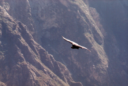
point. From our vantage point we watched around 20 to 30 Andean Condors rise from the depths of the canyon thousands of feet to disappear high above us. It was amazing how little they moved just circling up riding on the early morning thermals. The Andean Condor has a wing span of up to 10 feet (larger than the California Condor). 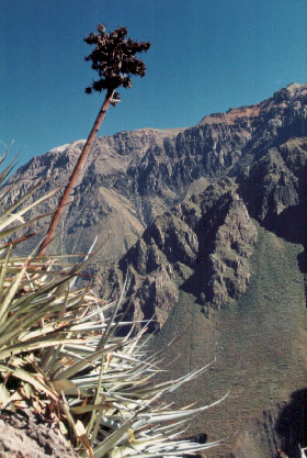
|
|
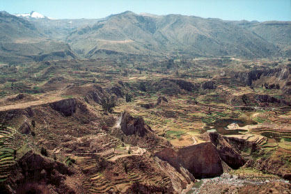 |
along the canyon rim viewing neat flowers, cactus, the drop off below us and the mountains above. Meanwhile our guide told us some history about the area. This included the perception of sacred animals with the condor representing heaven, the puma representing earth, and the serpent representing the underworld. We of course had a great vantage point to see more amazing terracing. |
|
volcanoes and over the next 5 days we tested our endurance, constitution, and will by climbing both. The first Chachani was the taller of the two at 6075m or 19930ft. We were spoiled by the guide company as they dropped us off at 16000 feet. Our guide Ivan was a experienced climber of the surrounding Andes and other ranges, but as a local who spoke English, we learned a lot about area, people, and how these two volcanoes played a part in peoples lives through the times. We hiked up to a base camp of 17500ft and set up camp. It was instantly below freezing as soon as the sun went down at 3:00pm since we were on the East side of the volcano. We basically huddled in the sleeping bags from that time until 12:00am trying to get some rest before the big climb . . . with little success. 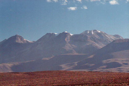
|
|
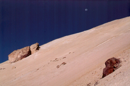 |
bags drank some hot tea and started up the mountain. It was a beautiful night and with the full moon we turned off our headlamps and hiked by the pale white light. We camped on the back left side of the mountain with respect to the photo and the tallest part of the peak is on the right. This meant that we had to climb and then descend several ridges on our way to the top. We also had to strap on and remove our crampons periodically (metal claws for the boots) as we encountered ice fields and glaciers. |
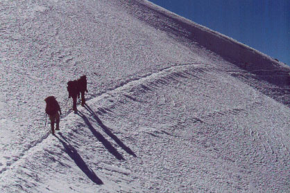
|
|
surrounding material was a lot of scree, ash, and sand that the volcano had tossed onto its sides. Every once in a while you would have to fight a bout of nausea that quickly came and went, and short headaches were also common through the group as we hiked upward. It was quite pleasant when we reached the top. The wind was mild and the sun thawed us out nicely. |
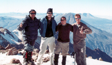
|
|
The next day we rested our tired bodies in hot springs of Yura preparing for the next climb. On the heals of the successful climb to almost 20000ft we were excited to try the more dramatic El Misty, which is 2825m or 19111ft. 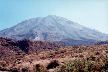
|
|
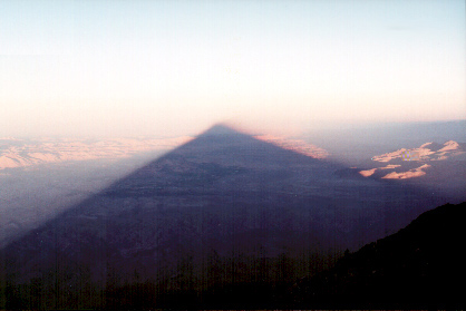 |
only bring us up to about 11000 feet making this a more formidable climb. We climbed up out of the flowering desert up to a base camp at of 14800ft. From here we watched the city get swallowed by the dark shadow of Misty. The weather was much more pleasant that night and we all were able to get some sleep . . . that is until the winds picked up. When we got up the next morning there was a brutal wind that chilled you to the bone if you stopped hiking. But besides the wind, it was another great hike with the moon again lighting our way. |
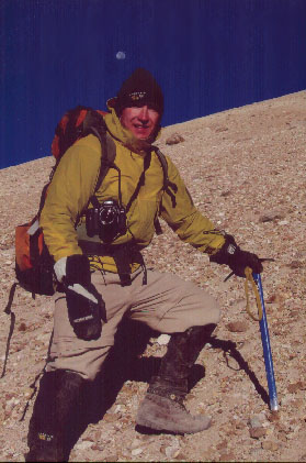
|
|
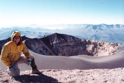 |
were sitting at the top looking down into the crater. Unlike Chachani, Misty is still active. Gases could be seen coming from the crater and the fresh sulfur thrown from the center was quite pungent at times. This time while quickly descending down the sandy side, we had the satisfaction of knowing this was the last mountain for a while. We again packed up camp and headed back to town to celebrate. |
|
|
 |
|
|
|
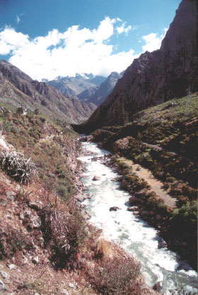
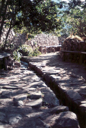
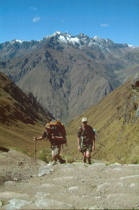
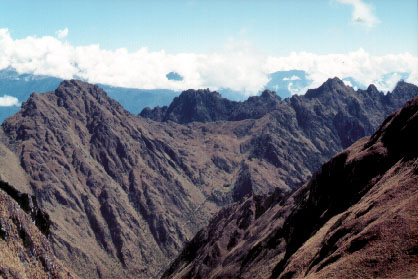
trail, uneven rock, and even steps carved out of the bedrock. There were many rock stairs to climb as the trail wound through valleys and over mountain passes. The weather was beautiful with everyday sunny. The view was amazing as we hiked through lower mountains with taller glaciated peaks surrounding us. |
|
|
|
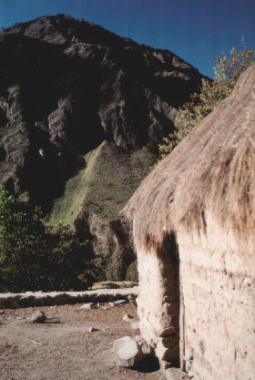
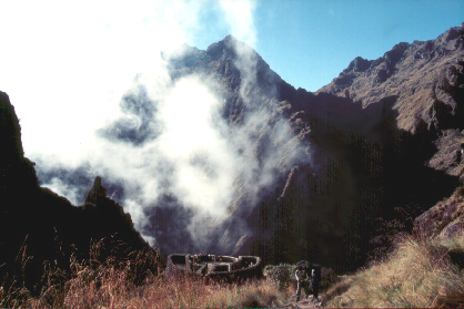
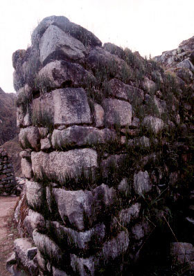
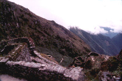
ruins. These were mainly thought to be used as outposts for smaller cities and checkpoints at trail junctures. It is said that there were runners ready at each one ready to carry a message or important product to the Inca ruler from anywhere in the empire. |
|
 |
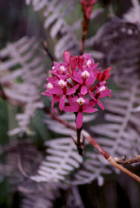 |
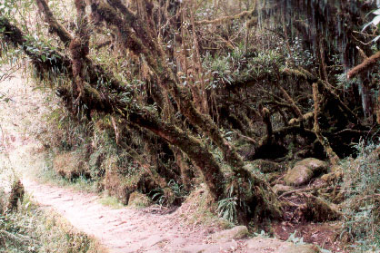
crossed mountain ranges the foliage slowly changed. We started moving into a cloud forest that was wetter and much more lush. Orchids and many other flowers brightened up the undergrowth and moss covered most everything. Apparently the rain forest of the Amazon starts not far from this area as you travel down out of the mountains. |
|
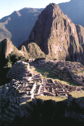
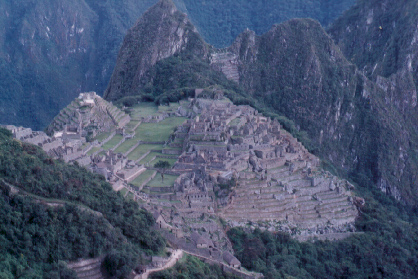
We however did not descend out of the mountains. Instead we hiked to the top of on mountain where the magnificent ancient city of Machu Picchu stands. Essentially, the Incas transformed the peak of a mountain in to a remote city to get away from the metropolis of Cusco, which had millions of people at the height of the empire. It was also used to get closer to Gods. It was so remote that it was forgotten about until the 20th century when it was finally unearthed from the overgrowth that had taken over for hundreds of years. |
|
 |
|
If you would like to see any other pictures of specific parts of the experience, or want higher resolution copies of what are on the web site, just let me know. Also, don't hesitate to ask if you have any questions. jon.pineau@colorado.edu Check out some pictures from other trips here |
|